My partner is off on holiday now for a couple days, and now my In Laws have moved in we decided to do a 5K walk, after a bit of reading and discussion we landed on Throop, an old village now part of Bournemouth. Little did I remember that with our family an hour walk takes 3 hours due to all the things we stop at look at with our various different interests.
The Walk
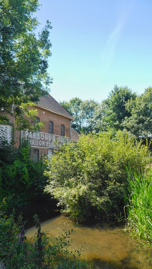
From the car park go left and you will see the old flour mill in front of you Throop Mill. Painted on the side you will see the name “Parsons and Sons” the names of the last family that operated it. Unfortunately it has been derelict since 1974. But it may date back to the 16th century but it is believed a mill of some sort has stood here since the 11th century due to it featuring in the doomsday book.
It is a Grade 2 listed building so the outside must remain intact but from what I understand the inside is 4 storeys of not much to be desired.
But looking upon it it is a beautiful building and I cannot believe I have not come here before. If you look carefully you can still see the water wheel out the front and listen for the water still rushing through the mill.
Follow the path alongside the mill and you will start to see the mill as it is on the dark side underneath its front side beautiful face; broken windows, cracked walls and graffiti. It is such a shame.
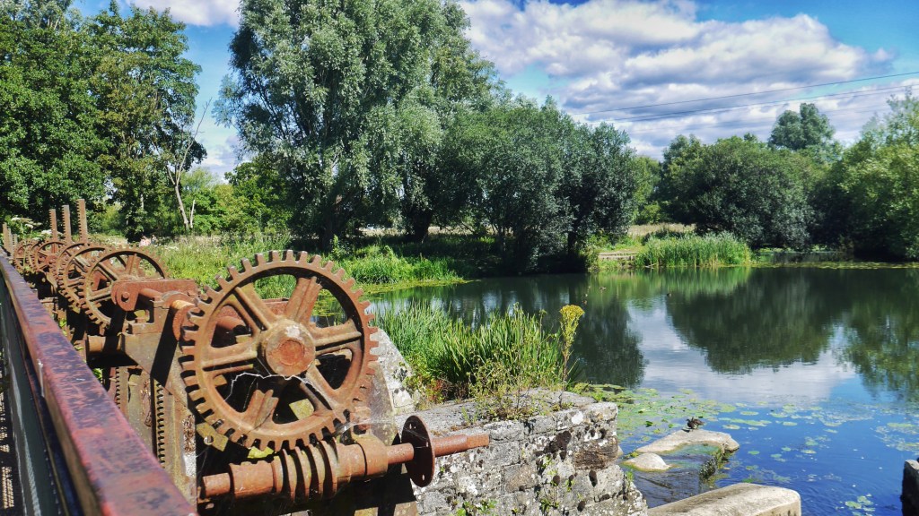
But continue round and you will come to the stream sluices.
Legend has it that the building is haunted, but what good derelict building isn’t? It is said that black coated figures are often seen and the sound of laughter can be heard from the ghosts of a group of a children who went missing in the area in the 1800’s.
Carry on walking and you will come to weir and bridge but due to timing we were unable to do this. Once you have though turn back and head to the road.
As you leave the mill turn right, walk back along the car park and continue on down this road.
Be careful as there is no pavement.
Turn left into Taylor drive, and gaze at the beautiful terraced houses and front gardens and flowers.
Turn right at lavender walk. And continue straight on through the field
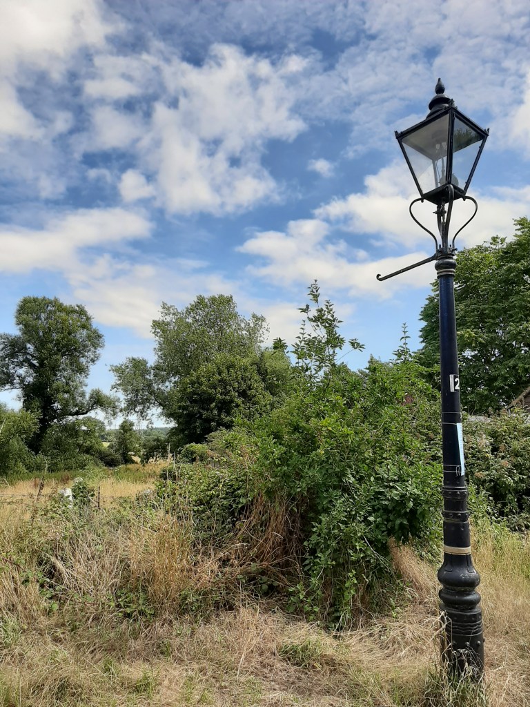
Look up and you will start to see old cast iron lamp posts. These date from the early 1900’s and are powered by gas wick and turned on by a clockwork timer mechanism which has to be wound weekly on all of them individually, this cannot be done remotely. As these are listed lamps they cannot be altered and the time they come on each day has to still correspond to the official light on time via the clockwork timer. A strong wind has been known to extinguish them.
In 1892 9000 lights in and around the Bournemouth were connected to the new electricity network. However the Throop and Holdenhurst villages were not connected to have electricity until the 1950’s! They were due to be converted to the electrical lamps but the company just forgot about these ones and they now have historical importance. There are 28 around Throop and Holdenhurst. See how many you can spot!
Continue straight onto Muscliffe Lane. Quickly spot on the right The Old Chapel and schoolhouse. Built in 1828, services were announced to the village by hoisting a white flag and a coice trumpet.
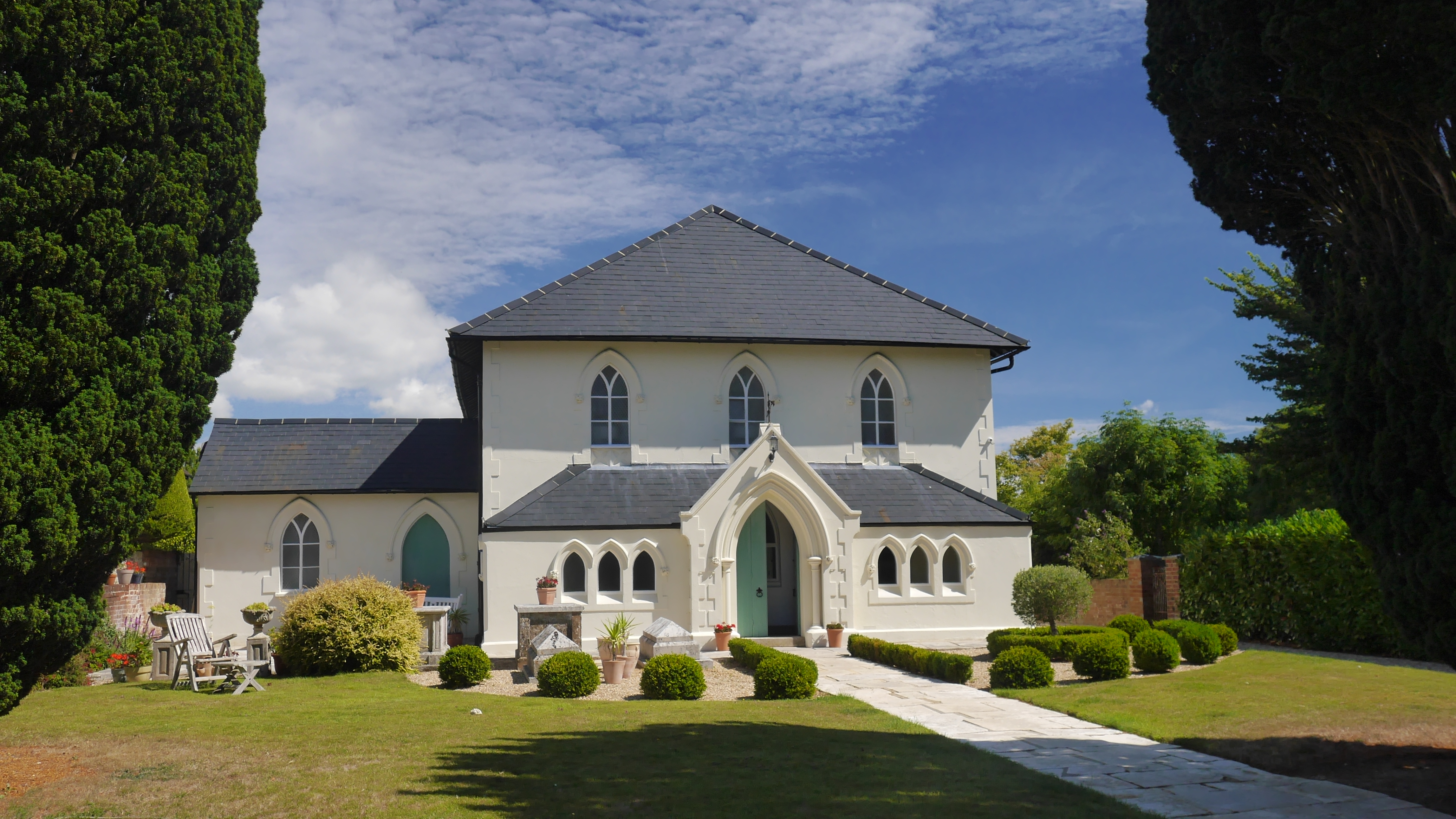
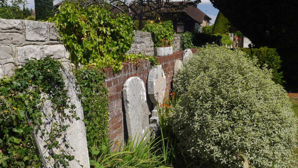
The chapel closed in 2010 but it looks like it is now a private residence, who live alongside the gravestones in their front garden!
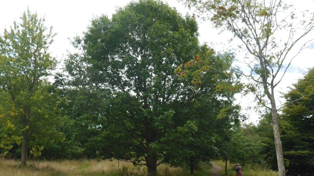
The walk along the lane is lovely. Lots of different farms to see. We saw kites flying, old tractors, beautiful fields and more.
We also were able to spot all 7 of the semi detached stallholders dwellings which were built in 1920 as part of Home for Heroes program to help our veterans after WW1. Spot all 7!
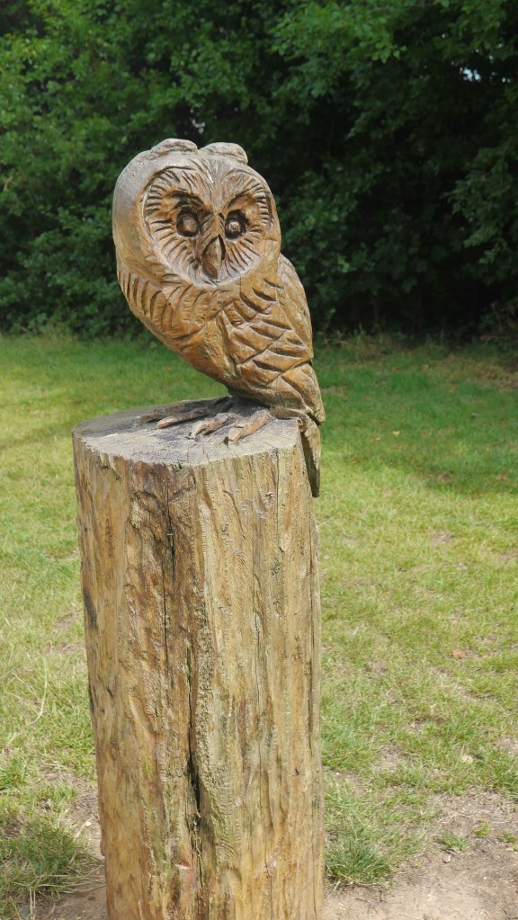
We continued on down this road until we got to Granby Road Car park. Go through and walk towards the river. You will go past numerous gorgeous wooden carvings of owls along the path way, keeping an eye on all who pass through.
There is also a lovely wild flower meadow, but unfortunately on our trip there was a lady sitting in the middle on the bench puffing away on a cigarette so we didn’t go in.
There is a visitors centre on the left that also sells teas, cakes and ice creams. It also has good information and leaflets on local walks and wildlife. Due to this pandemic however at the current time visitors are unable to enter inside and the toilets are not open.
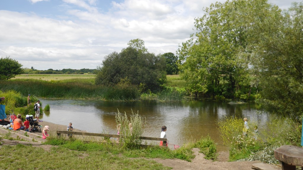
This is a beautiful part of the river stour, with shallow and crystal clear water and a stepped beach area it is perfect for taking the little ones paddling on a hot day. But shhhh don’t tell everyone this secret place 😉
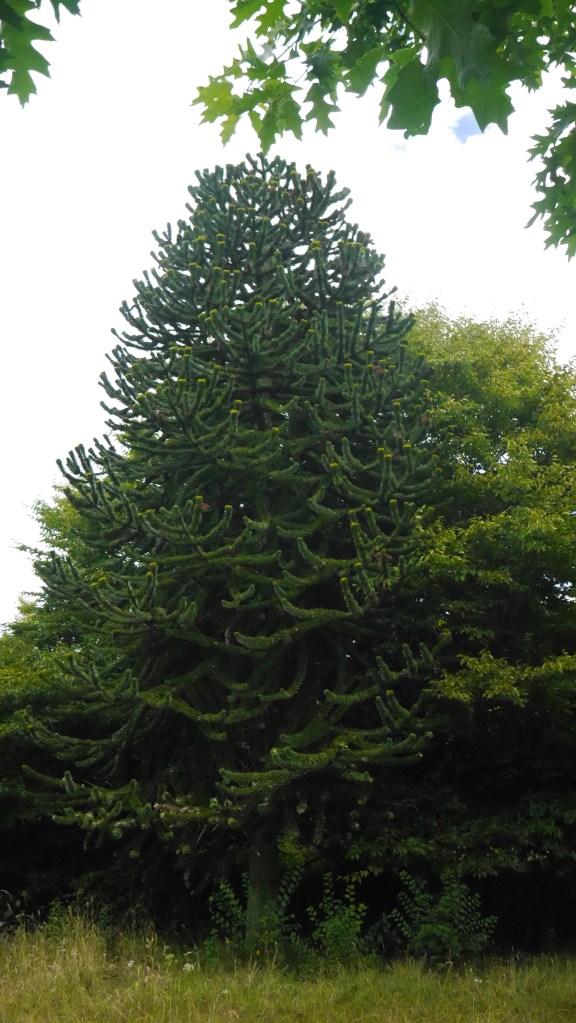
Turn right at the river and you will shortly come across some steps to your right. These lead up to the Aboretum. There at least 80 different specimens of trees in here, having plaques on them to tell you what they are, they are some beautiful, amazing and odd looking trees. Even if you normally are not that bothered about trees this is a really fascinating little area to walk round and discover.
Head back to the river, the is an entrance pathway either end of the Aboretum.
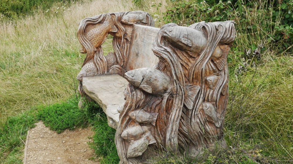
Continue walking and following the main path. Look out for the beautiful wooden carved benches scattered around.
These fields you walk past after the recycling centre are where the Red Arrows pilot tragically crashed in and lost his life in 2011 during the Bournemouth air festival, the memorial for him is at the beach.
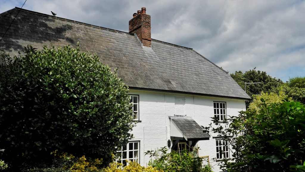
Eventually on the left you will see Muccleshell farmhouse which is believed to be the oldest complete structure in Bournemouth, with some parts dating as far back as 1587. Legend has it Charles II hid here for one night after his defeat in battle in 1651.
You can only see this from the roadside but peer sneakily over the wall and you will see a beautiful garden.
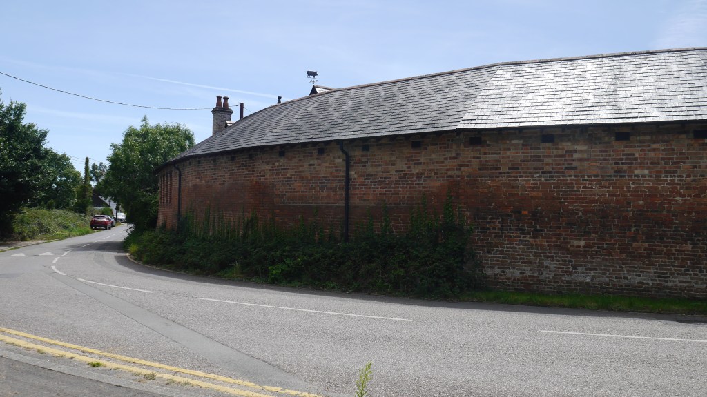
You will come to a large round building on the corner I couldn’t find much about it except that it was the old piggery, but is quite an impressive building just randomly there.
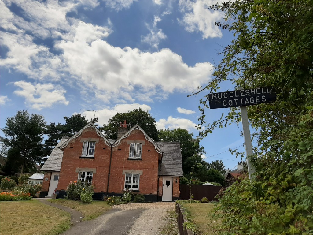
Next up is Muccleshell Cottages on your left. Beautiful cottages that are remnants of the lost village of Muccleshell. Which sounds more exciting than it really is. It was simply swallowed up by Throop in the 1800’s.
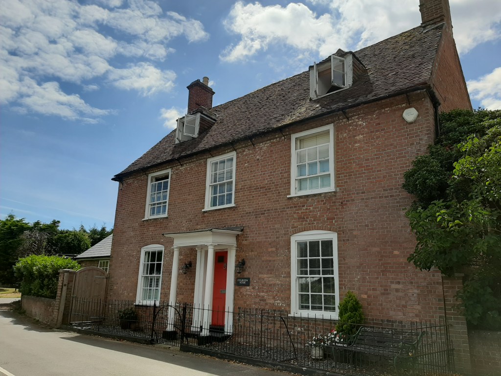
And last but not least just down the road is Stourview House. Which dates to 1790ish and was the home of the official biscuit maker and supplier to the british navy. Likely he supplied biscuits to the HMS Victory to Nelson.
Carry on and you will find yourself back at the car park. Phew! Time to go home rest up with a cuppa!
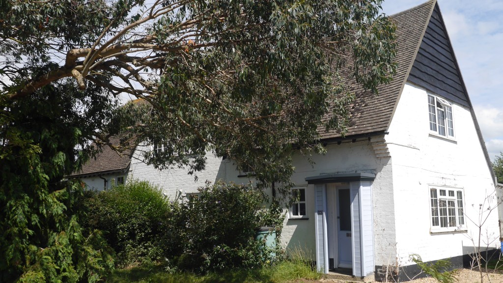
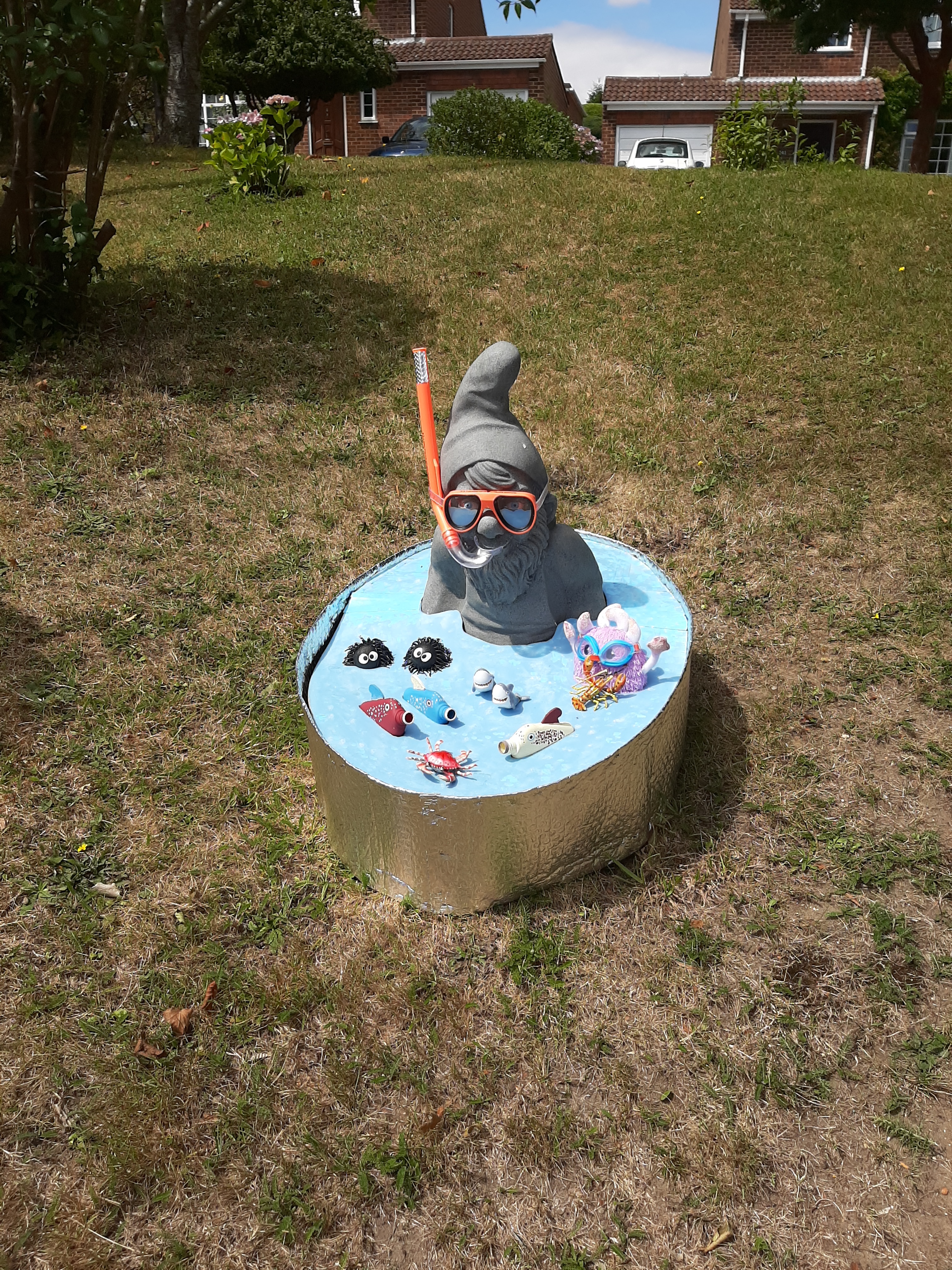
Oh and I just had to include this photo from a garden we walked by, it made me smile 🙂
Getting there and parking
For sat nav purposes use post code BH8 0DL this should take you to the road and you will soon see the car park.
Car park is free and has no time limit but it is small.
Important note, the first half of this walk is along country roads with no pavement. Take care even though it is not a busy road.
This is about 5K route roughly.
